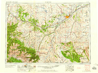
1958 Map of Billings
USGS Topo · Published 1958About this map
Billings serves as the regional anchor in this mid-century survey, situated at the convergence of the Yellowstone River and a dense network of major transportation lines including the Northern Pacific and Chicago Burlington and Quincy railroads. The landscape transitions sharply from the agricultural river valleys and the Lake Basin in the north to the formidable peaks of the Custer National Forest in the southwest. This area contains the highest point in Montana, Granite Peak, surrounded by a concentration of glacial features like Rainbow Lake and the Stillwater Plateau. To the south and east, the industrial character of the era is evident in the Elk Basin Oil and Gas Field and scattered oil wells near Bridger. The presence of the Crow Indian Reservation and the Hailstone National Wildlife Refuge underscores the diverse land management and preservation priorities at play during this period of post-war development.
Find a feature on this map
146 named features on this map. Tap any name to fly to it.
Don’t see what you’re looking for? This feature index may not catch every label — zoom into the map to look around manually.
Map Details
Editions of this 1958 Billings Map
2 editions found

Other maps of this area

1886 · Canyon
USGS Topo · 1:125,000

1886 · Little Belt Mts.
USGS Topo · 1:250,000

1889 · Big Snowy Mountain
USGS Topo · 1:250,000

1891 · Livingston
USGS Topo · 1:250,000

1891 · Big Timber
USGS Topo · 1:125,000

1892 · Stillwater
USGS Topo · 1:125,000

1893 · Livingston
USGS Topo · 1:250,000

1893 · Big Snowy Mountain
USGS Topo · 1:250,000

1893 · Big Timber
USGS Topo · 1:125,000

1893 · Huntley
USGS Topo · 1:125,000