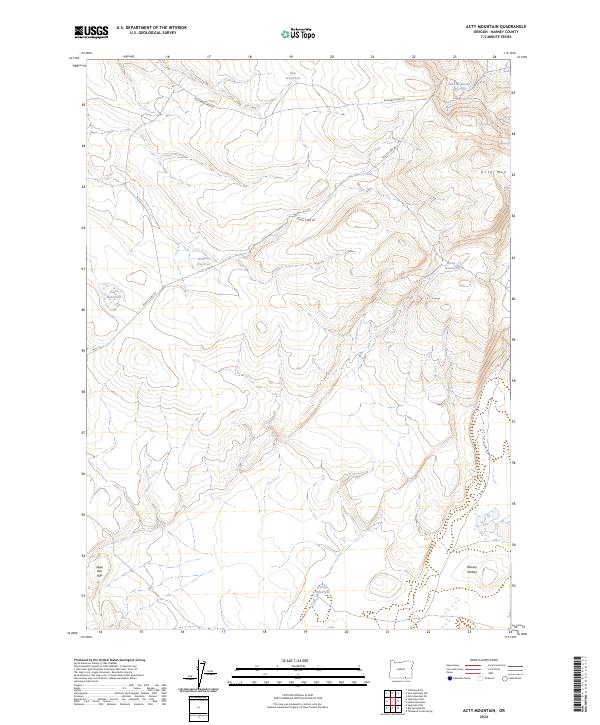
2024 Map of Acty Mountain
USGS Topo · Published 2024About this map
Acty Mtn stands as the central topographic focal point in this portion of Harney County, a landscape defined by isolated water sources and high-desert terrain. The distribution of features like Snip Waterhole, Stallion Waterhole, and Rastus Waterhole across the map highlights the critical importance of localized water management in this arid region of Oregon. These waterholes, along with Bald Mountain Reservoir and Halfway Reservoir, indicate a land use pattern geared toward livestock grazing and range management, where every catchment is a vital landmark.
Find a feature on this map
16 named features on this map. Tap any name to fly to it.
Don’t see what you’re looking for? This feature index may not catch every label — zoom into the map to look around manually.
Map Details
Editions of this 2024 Acty Mountain Map
This is the sole edition of this map. No revisions or reprints were ever made.
Other maps of this area

1889 · Long Valley
USGS Topo · 1:250,000

1954 · Vya
USGS Topo · 1:250,000

1955 · Adel
USGS Topo · 1:250,000

1957 · Adel
USGS Topo · 1:250,000

1958 · Vya
USGS Topo · 1:250,000

1958 · Adel
USGS Topo · 1:250,000

1962 · Vya
USGS Topo · 1:250,000

1962 · Adel
USGS Topo · 1:250,000

1966 · Big Spring Butte
USGS Topo · 1:62,500
1966 · Sage Hen Hills
USGS Topo · 1:24,000