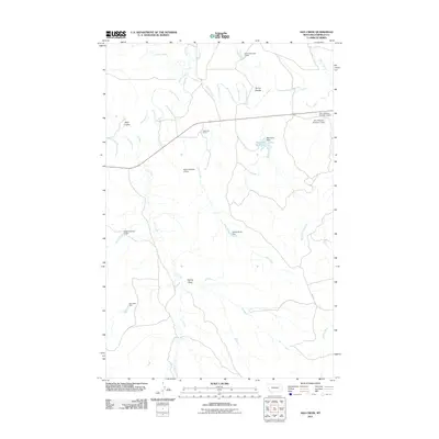
2011 Map of Ada Creek
USGS Topo · Published 2011About this map
Mahoney Ranch stands as a primary point of human habitation in this sparsely populated stretch of Garfield County, where the management of water is central to the landscape. A complex network of small dams and reservoirs, including Murnions Reservoir and Karen Number 3 Dam, illustrates the ranching and agricultural adaptations required in the northern Montana plains. The terrain is defined by dry watercourses and seasonal drainages like Ada Creek and Big Dry Creek, which cut through the landscape alongside features such as Sonny Coulee.
Find a feature on this map
22 named features on this map. Tap any name to fly to it.
Don’t see what you’re looking for? This feature index may not catch every label — zoom into the map to look around manually.
Map Details
Editions of this 2011 Ada Creek Map
This is the sole edition of this map. No revisions or reprints were ever made.
Other maps of this area

1954 · Jordan
USGS Topo · 1:250,000

1956 · Jordan
USGS Topo · 1:250,000

1958 · Jordan
USGS Topo · 1:250,000

1964 · Jordan
USGS Topo · 1:250,000

1964 · Ada Creek
USGS Topo · 1:24,000

1964 · Bateman Coulee
USGS Topo · 1:24,000

1964 · Black John Coulee
USGS Topo · 1:24,000

1964 · Bateman Coulee NE
USGS Topo · 1:24,000
1965 · York Reservoir
USGS Topo · 1:24,000

1965 · Hafla School
USGS Topo · 1:24,000