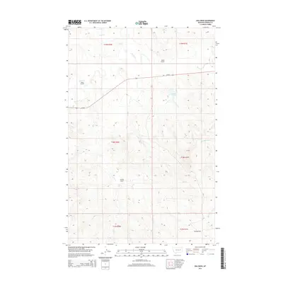
2014 Map of Ada Creek
USGS Topo · Published 2014About this map
Murnions Reservoir and the drainage of Big Dry Cr define the landscape of this Garfield County interior, where the high plains are carved by an intricate network of coulees and draws. The terrain is marked by a characteristic western ranching geography, where water features like Ada Cr and Frazier Cr dictated the placement of early homesteads and grazing boundaries. The sparse human footprint is centered on MT-200, which cuts east-to-west through the northern half of the sheet, providing the primary connection across this expansive section of Montana.
Find a feature on this map
19 named features on this map. Tap any name to fly to it.
Don’t see what you’re looking for? This feature index may not catch every label — zoom into the map to look around manually.
Map Details
Editions of this 2014 Ada Creek Map
This is the sole edition of this map. No revisions or reprints were ever made.
Other maps of this area

1954 · Jordan
USGS Topo · 1:250,000

1956 · Jordan
USGS Topo · 1:250,000

1958 · Jordan
USGS Topo · 1:250,000

1964 · Jordan
USGS Topo · 1:250,000

1964 · Ada Creek
USGS Topo · 1:24,000

1964 · Bateman Coulee
USGS Topo · 1:24,000

1964 · Black John Coulee
USGS Topo · 1:24,000

1964 · Bateman Coulee NE
USGS Topo · 1:24,000
1965 · York Reservoir
USGS Topo · 1:24,000

1965 · Hafla School
USGS Topo · 1:24,000