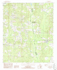
1986 Map of Ada
USGS Topo · Published 1986About this map
The intersection of three parishes—Webster, Claiborne, and Bienville—shapes this mid-1980s landscape of northwestern Louisiana. Small settlements such as Ada, Dubberly, and Nine Forks anchor a region defined by its complex drainage network and early industrial activity. The terrain is deeply carved by waterways including Black Lake Bayou, Bear Creek, and Brushy Creek, which feed into the larger Black Bayou system. Resource extraction is evident through labeled Gravel Pits and a Drill Hole, indicating the area's continued connection to natural resource production. This provisional survey provides a clear look at the rural infrastructure of the era, from the scattered Cemeteries to the Sewage Disposal Ponds near Ada, documenting the functional layout of these small communities before further modern expansion.
Find a feature on this map
19 named features on this map. Tap any name to fly to it.
Don’t see what you’re looking for? This feature index may not catch every label — zoom into the map to look around manually.
Map Details
Editions of this 1986 Ada Map
This is the sole edition of this map. No revisions or reprints were ever made.
Other maps of this area

1947 · Ringgold
USGS Topo · 1:62,500

1947 · Minden
USGS Topo · 1:62,500

1948 · Jamestown
USGS Topo · 1:62,500

1949 · Jamestown
USGS Topo · 1:62,500

1949 · Minden
USGS Topo · 1:62,500

1949 · Gibsland
USGS Topo · 1:62,500

1950 · Gibsland
USGS Topo · 1:62,500

1955 · Shreveport
USGS Topo · 1:250,000

1956 · Shreveport
USGS Topo · 1:250,000

1956 · Ringgold
USGS Topo · 1:62,500