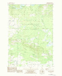
1983 Map of Addis Creek
USGS Topo · Published 1984About this map
The Pere Marquette State Forest dominates this section of Missaukee County, where the landscape is defined by extensive wetlands and water management. Significant hydrological features include the Big Cannon Creek No 1 Flooding and Big Cannon Creek No 2 Flooding, both regulated by the Stratford Dam. These managed floodings and the surrounding Dead Stream Swamp illustrate the region's focus on conservation and wildlife habitat during the early 1980s.
Find a feature on this map
49 named features on this map. Tap any name to fly to it.
Don’t see what you’re looking for? This feature index may not catch every label — zoom into the map to look around manually.
Map Details
Editions of this 1983 Addis Creek Map
This is the sole edition of this map. No revisions or reprints were ever made.
Other maps of this area

1949 · Fletcher
USGS Topo · 1:62,500

1950 · Cote Dame Marie
USGS Topo · 1:24,000

1950 · Fletcher
USGS Topo · 1:24,000

1954 · Traverse City
USGS Topo · 1:250,000

1956 · Kalkaska
USGS Topo · 1:62,500

1956 · Houghton Lake
USGS Topo · 1:62,500

1956 · Lake City
USGS Topo · 1:62,500

1958 · Traverse City
USGS Topo · 1:250,000

1983 · Cadillac
USGS Topo · 1:100,000
1983 · Meads Landing
USGS Topo · 1:25,000
Featured Places
- Norwich Township, MI
- Enterprise Township, MI
- West Branch Township, MI
- Missaukee County, MI
- United States