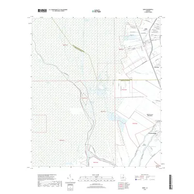
2018 Map of Addis
USGS Topo · Published 2018About this map
Plaquemine and the surrounding Iberville Parish landscape are defined by a complex network of man-made canals and ancient bayous in this 2018 survey. The intersection of the Gulf Intracoastal Waterway and the Port Allen Canal highlights the region's importance to modern maritime commerce, while the winding course of Bayou Plaquemine and Bayou Jacob reflects the older, natural drainage patterns of the low-lying delta. Settlement is concentrated along the higher ground of the river levees and former plantation lands, notably at Addis and Chenango. The map documents significant local landmarks such as the Myrtle Grove Plantation and several burial sites including Grace Memorial Park Cem and Little Zion Church Cem. This contemporary view provides a baseline for understanding the evolving water management and land use near the West Baton Rouge Parish line.
Find a feature on this map
70 named features on this map. Tap any name to fly to it.
Don’t see what you’re looking for? This feature index may not catch every label — zoom into the map to look around manually.
Map Details
Editions of this 2018 Addis Map
This is the sole edition of this map. No revisions or reprints were ever made.
Other maps of this area

1908 · Baton Rouge
USGS Topo · 1:62,500

1935 · Chicot Lake
USGS Topo · 1:62,500

1936 · White Castle
USGS Topo · 1:62,500

1939 · Baton Rouge
USGS Topo · 1:62,500

1940 · Grosse Tete
USGS Topo · 1:62,500

1953 · Baton Rouge West
USGS Topo · 1:24,000

1953 · Crescent
USGS Topo · 1:24,000

1953 · Plaquemine
USGS Topo · 1:24,000

1953 · Lobdell
USGS Topo · 1:24,000

1953 · Pigeon Bay
USGS Topo · 1:24,000