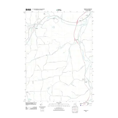
2012 Map of Addison
USGS Topo · Published 2012About this map
The Canisteo River and Tioga River converge in this section of Steuben County, shaping a landscape defined by river valleys and agricultural plateaus. The village of Addison sits at the western edge, while smaller settlements like Erwins, Presho, and Lindley track the path of the southern river corridor. This 2012 survey illustrates the modern road network, including the major arterial route following the Tioga valley, contrasted against numerous rural corridors such as Stead School Rd and Liberty Pole Rd. For those researching local family history, several burial sites are clearly marked, including Jones-Erwin Cemetery and Nichols Cemetery. The presence of the Towner Farm Airport near the northern bend of the Canisteo highlights the continued importance of private aviation in the rural Southern Tier.
Find a feature on this map
75 named features on this map. Tap any name to fly to it.
Don’t see what you’re looking for? This feature index may not catch every label — zoom into the map to look around manually.
Map Details
Editions of this 2012 Addison Map
This is the sole edition of this map. No revisions or reprints were ever made.
Other maps of this area

1900 · Tioga
USGS Topo · 1:62,500

1900 · Elkland
USGS Topo · 1:62,500

1902 · Tioga
USGS Topo · 1:62,500

1914 · Corning
USGS Topo · 1:62,500

1924 · Woodhull
USGS Topo · 1:48,000

1926 · Woodhull
USGS Topo · 1:62,500

1944 · Woodhull
USGS Topo · 1:62,500

1944 · Corning
USGS Topo · 1:62,500

1950 · Elmira
USGS Topo · 1:250,000

1953 · Campbell
USGS Topo · 1:24,000