
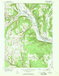
1953 Map of Campbell
USGS Topo · Published 1954About this map
The Cohocton River valley serves as a primary transportation corridor through central Steuben County, where the parallel tracks of the Erie RR and the Delaware Lackawanna and Western RR navigate the winding riverbanks. The settlement of Campbell stands as a central hub, supported by local institutions like the Central Sch and nearby Riverside Cem. This mid-century landscape is defined by its transition from the industrial activity along the river to the higher elevations of Thurston and Addison, where the terrain is marked by smaller family-named landmarks like Hope Cem and Nute Cem.
Find a feature on this map
38 named features on this map. Tap any name to fly to it.
Don’t see what you’re looking for? This feature index may not catch every label — zoom into the map to look around manually.
Map Details
Editions of this 1953 Campbell Map
2 editions found
Other maps of this area

1903 · Hammondsport
USGS Topo · 1:62,500

1910 · Bath
USGS Topo · 1:62,500

1914 · Corning
USGS Topo · 1:62,500

1924 · Woodhull
USGS Topo · 1:48,000

1926 · Woodhull
USGS Topo · 1:62,500

1944 · Woodhull
USGS Topo · 1:62,500

1944 · Corning
USGS Topo · 1:62,500

1950 · Elmira
USGS Topo · 1:250,000

1953 · Bradford
USGS Topo · 1:24,000
1953 · Corning
USGS Topo · 1:24,000