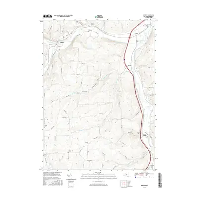
2016 Map of Addison
USGS Topo · Published 2016About this map
Canisteo River and Tioga River converge within this Steuben County landscape, framing a region defined by its valley settlements and upland ridges. The village of Addison serves as a primary hub along the northern waterway, while the smaller hamlets of Presho, Erwins, and Lindley track the eastern river corridor. Transportation history is etched into the terrain via numerous spans including the Canisteo River Bridge and Tioga River Bridge, alongside aviation infrastructure like the Towner Farm Airport. For those researching local lineages, the map identifies several burial grounds such as Freeman Cem, Liberty Pole Cem, and Fairview Cem. Numerous hollows and brooks, including Beeman Hollow and Reuben Brook, branch off the main valleys toward Orr Hill, illustrating the traditional drainage and settlement patterns of the Southern Tier.
Find a feature on this map
100 named features on this map. Tap any name to fly to it.
Don’t see what you’re looking for? This feature index may not catch every label — zoom into the map to look around manually.
Map Details
Editions of this 2016 Addison Map
This is the sole edition of this map. No revisions or reprints were ever made.
Other maps of this area

1900 · Tioga
USGS Topo · 1:62,500

1900 · Elkland
USGS Topo · 1:62,500

1902 · Tioga
USGS Topo · 1:62,500

1914 · Corning
USGS Topo · 1:62,500

1924 · Woodhull
USGS Topo · 1:48,000

1926 · Woodhull
USGS Topo · 1:62,500

1944 · Woodhull
USGS Topo · 1:62,500

1944 · Corning
USGS Topo · 1:62,500

1950 · Elmira
USGS Topo · 1:250,000

1953 · Campbell
USGS Topo · 1:24,000