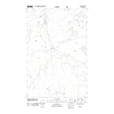
2011 Map of Addy
USGS Topo · Published 2011About this map
Addy and Bluecreek anchor this portion of the Colville River valley, where the landscape reflects a long-standing reliance on the region's geological resources. The Colville River flows through the center of the sheet, flanked by the Addy Post Office and heavy industrial footprints such as the Addy Dolomite Quarry and the Addy Pit. The surrounding terrain rises toward Riecker Mountain in the west and Deer Mountain in the east, with various mining operations scattered across the foothills.
Find a feature on this map
45 named features on this map. Tap any name to fly to it.
Don’t see what you’re looking for? This feature index may not catch every label — zoom into the map to look around manually.
Map Details
Editions of this 2011 Addy Map
This is the sole edition of this map. No revisions or reprints were ever made.
Other maps of this area

1927 · Chewelah
USGS Topo · 1:125,000

1930 · Chewelah
USGS Topo · 1:125,000

1958 · Sandpoint
USGS Topo · 1:250,000

1963 · Sandpoint
USGS Topo · 1:250,000

1964 · Chewelah
USGS Topo · 1:24,000

1964 · Cliff Ridge
USGS Topo · 1:24,000

1964 · Chewelah Mtn
USGS Topo · 1:62,500

1965 · Waitts Lake
USGS Topo · 1:24,000
1965 · Addy
USGS Topo · 1:24,000
1965 · Dunn Mountain
USGS Topo · 1:24,000