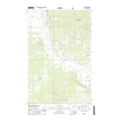
2017 Map of Addy
USGS Topo · Published 2017About this map
The Colville River carves a central valley through this Stevens County landscape, serving as the primary corridor for the communities of Addy and Chewelah. This 2017 survey highlights the transition between the agricultural bottomlands of the Colville Valley and the elevated terrain of the Colville National Forest to the east. The river is fed by numerous drainages, including Addy Cr and Stensgar Cr, which flow from the surrounding highlands like Deer Mtn and the Iron Mountains. Aviation and recreation are marked by the Bluecreek Airport and the vicinity of Buck Lake and Doe Lake in the southern reaches. The map documents a complex network of county roads and forest routes, such as Co HWY 9325 and the Iron Mtn-Immel Branch Rd, that provide access to timberlands and remote landmarks like Gold Hill and McKale Canyon.
Find a feature on this map
47 named features on this map. Tap any name to fly to it.
Don’t see what you’re looking for? This feature index may not catch every label — zoom into the map to look around manually.
Map Details
Editions of this 2017 Addy Map
This is the sole edition of this map. No revisions or reprints were ever made.
Other maps of this area

1927 · Chewelah
USGS Topo · 1:125,000

1930 · Chewelah
USGS Topo · 1:125,000

1958 · Sandpoint
USGS Topo · 1:250,000

1963 · Sandpoint
USGS Topo · 1:250,000

1964 · Chewelah
USGS Topo · 1:24,000

1964 · Cliff Ridge
USGS Topo · 1:24,000

1964 · Chewelah Mtn
USGS Topo · 1:62,500

1965 · Waitts Lake
USGS Topo · 1:24,000
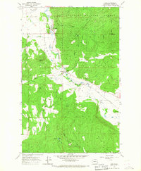
1965 · Addy
USGS Topo · 1:24,000
1965 · Dunn Mountain
USGS Topo · 1:24,000