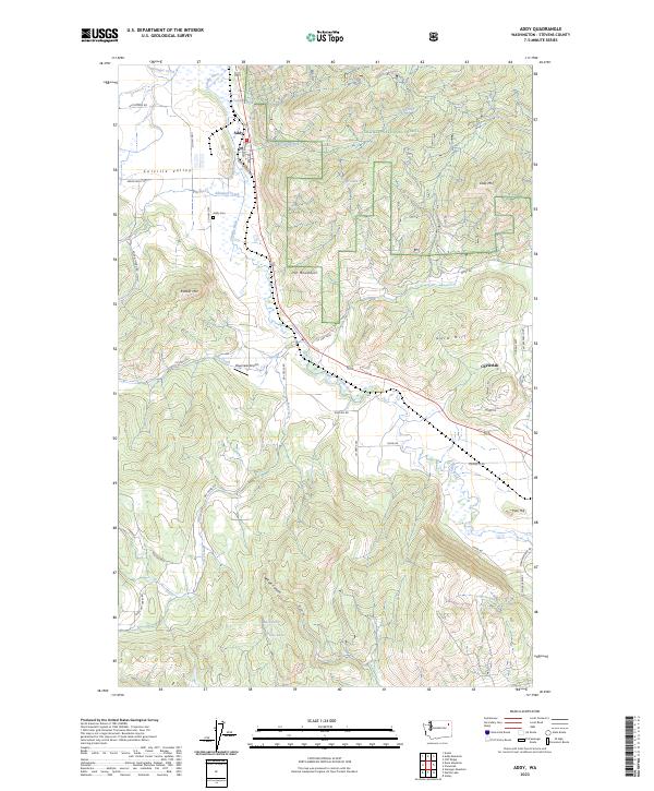
2023 Map of Addy
USGS Topo · Published 2023About this map
Addy serves as the central hub of this Colville Valley landscape, situated where Addy Creek meets the southward-flowing Colville River. This 2023 edition documents the area's mix of valley floor agriculture and the higher elevations of the Colville National Forest to the east and west. Genealogists and local historians will find the Addy Cem near the town center, while those studying early aviation can locate the Bluecreek Airport along the valley floor. The map tracks the complex hydrology of the region, from the winding path of Stensgar Creek to the secluded Buck Lake in the southern hills. Notable peaks like Riecker Mtn and the Iron Mountains define the local topography, marking the transition from settled river bottomlands to the wooded slopes of the national forest.
Find a feature on this map
49 named features on this map. Tap any name to fly to it.
Don’t see what you’re looking for? This feature index may not catch every label — zoom into the map to look around manually.
Map Details
Editions of this 2023 Addy Map
This is the sole edition of this map. No revisions or reprints were ever made.
Other maps of this area

1927 · Chewelah
USGS Topo · 1:125,000

1930 · Chewelah
USGS Topo · 1:125,000

1958 · Sandpoint
USGS Topo · 1:250,000

1963 · Sandpoint
USGS Topo · 1:250,000

1964 · Chewelah
USGS Topo · 1:24,000

1964 · Cliff Ridge
USGS Topo · 1:24,000

1964 · Chewelah Mtn
USGS Topo · 1:62,500

1965 · Waitts Lake
USGS Topo · 1:24,000
1965 · Addy
USGS Topo · 1:24,000
1965 · Dunn Mountain
USGS Topo · 1:24,000