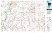
1994 Map of Adel
USGS Topo · Published 1994About this map
Hart Mountain National Antelope Refuge dominates this section of the high desert, where the dramatic fault-block topography of Hart Mountain overlooks the expansive Warner Valley. The landscape is a network of alkaline lakes and seasonal reservoirs, including Hart Lake, Crump Lake, and Pelican Lake, which define the region's limited water resources. Small settlements like Adel and Plush serve as isolated outposts in a terrain marked by wide flats and volcanic features like Cat Butte and Adams Knoll.
Find a feature on this map
50 named features on this map. Tap any name to fly to it.
Don’t see what you’re looking for? This feature index may not catch every label — zoom into the map to look around manually.
Map Details
Editions of this 1994 Adel Map
This is the sole edition of this map. No revisions or reprints were ever made.
Other maps of this area

1886 · Alturas
USGS Topo · 1:250,000

1886 · Disaster
USGS Topo · 1:250,000

1889 · Long Valley
USGS Topo · 1:250,000

1892 · Alturas
USGS Topo · 1:250,000

1893 · Disaster
USGS Topo · 1:250,000

1954 · Vya
USGS Topo · 1:250,000

1954 · Alturas
USGS Topo · 1:250,000

1955 · Klamath Falls
USGS Topo · 1:250,000

1955 · Adel
USGS Topo · 1:250,000

1957 · Adel
USGS Topo · 1:250,000