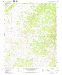
1963 Map of Adobe Downs Ranch
USGS Topo · Published 1980About this map
The Southern Ute Indian Reservation dominates the northern landscape of this San Juan County region, where the high desert terrain is defined by a complex network of glades and arroyos. This 1963 survey, updated with 1978 aerial data, captures the intersection of ranching life and natural resource extraction. Established sites like Adobe Downs Ranch and the Wilson Ranch are surrounded by an infrastructure of small-scale water management, evidenced by features such as Pee Wee Dam, Camel Hump Dam, and Zebra Hills Dam. The reliance on local water sources is further highlighted by Mosley Spring and Coyote Spring. Significant geological features such as Bohanan Canyon and Jaquez Flat are interspersed with numerous gas wells, indicating the burgeoning energy industry of the mid-20th century. The Farmington Glade Road serves as a primary artery through this arid expanse, connecting the various glades and ranching outposts across the Colorado and New Mexico border.
Find a feature on this map
36 named features on this map. Tap any name to fly to it.
Don’t see what you’re looking for? This feature index may not catch every label — zoom into the map to look around manually.
Map Details
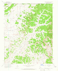
Editions of this 1963 Adobe Downs Ranch Map
2 editions found
Other maps of this area

1889 · Largo
USGS Topo · 1:250,000

1889 · Chaco
USGS Topo · 1:250,000

1892 · Chaco
USGS Topo · 1:250,000

1895 · Largo
USGS Topo · 1:250,000

1908 · Ignacio
USGS Topo · 1:125,000

1913 · Red Mesa
USGS Topo · 1:62,500

1924 · Ignacio
USGS Topo · 1:125,000

1945 · Durango
USGS Topo · 1:250,000

1953 · Durango
USGS Topo · 1:250,000

1954 · Durango
USGS Topo · 1:250,000