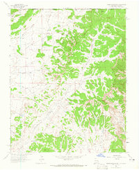
1963 Map of Adobe Downs Ranch
USGS Topo · Published 1965About this map
Southern Ute Indian Reservation lands dominate the northern boundary of this high-desert landscape along the Colorado and New Mexico state line. The early 1960s terrain is defined by an intricate network of glades and arroyos, including Dusenberry Glade, Martin Glade, and Jaquez Arroyo, which channel seasonal water toward Hartley Wash. Human settlement is sparse, anchored by the Wilson Ranch and supported by a series of small water management features such as Pee Wee Dam, Vee Dam, and Zebra Hills Dam. The expansion of the energy industry is evident through numerous Gas Wells scattered across the mesas. Transportation is limited to rugged tracks like Farmington Road and Glade Road, which follow the natural contours of the land between Jaquez Flat and the deep incisions of Bohanan Canyon.
Find a feature on this map
31 named features on this map. Tap any name to fly to it.
Don’t see what you’re looking for? This feature index may not catch every label — zoom into the map to look around manually.
Map Details
Editions of this 1963 Adobe Downs Ranch Map
2 editions found
Other maps of this area

1889 · Largo
USGS Topo · 1:250,000

1889 · Chaco
USGS Topo · 1:250,000

1892 · Chaco
USGS Topo · 1:250,000

1895 · Largo
USGS Topo · 1:250,000

1908 · Ignacio
USGS Topo · 1:125,000

1913 · Red Mesa
USGS Topo · 1:62,500

1924 · Ignacio
USGS Topo · 1:125,000

1945 · Durango
USGS Topo · 1:250,000

1953 · Durango
USGS Topo · 1:250,000

1954 · Durango
USGS Topo · 1:250,000