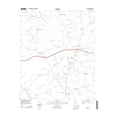
2014 Map of Adrian
USGS Topo · Published 2014About this map
Kingston Lake and a complex network of coastal plain wetlands define this portion of Horry County, South Carolina. The landscape is characterized by numerous "bays" and swamps, such as Brown Bay and Chinners Swamp, which historically dictated the placement of settlements and transport routes. Clusters of activity are centered around rural junctions like Adrian, Baker Crossroads, and Saint Paul Forks, reflecting a dispersed agricultural and timber-based community structure. Local family and church history is grounded in landmarks such as Thompson Cem and Mt Pisgah Cemetery Rd. The presence of the Hoffman Pond Dam on Grier Swamp highlights the management of water resources in this low-lying region, where drainage features like Brown Swamp and Poplar Swamp converge toward the deeper basin near Homewood.
Find a feature on this map
162 named features on this map. Tap any name to fly to it.
Don’t see what you’re looking for? This feature index may not catch every label — zoom into the map to look around manually.
Map Details
Editions of this 2014 Adrian Map
This is the sole edition of this map. No revisions or reprints were ever made.
Other maps of this area

1937 · Nixonville
USGS Topo · 1:48,000

1942 · Nixonville
USGS Topo · 1:62,500

1943 · Dongola
USGS Topo · 1:24,000

1943 · Adrian
USGS Topo · 1:24,000

1943 · Horry
USGS Topo · 1:24,000

1943 · Conway
USGS Topo · 1:24,000

1944 · Adrian
USGS Topo · 1:31,680

1948 · Galivants Ferry
USGS Topo · 1:24,000

1948 · Bayboro
USGS Topo · 1:24,000

1949 · Bayboro
USGS Topo · 1:24,000