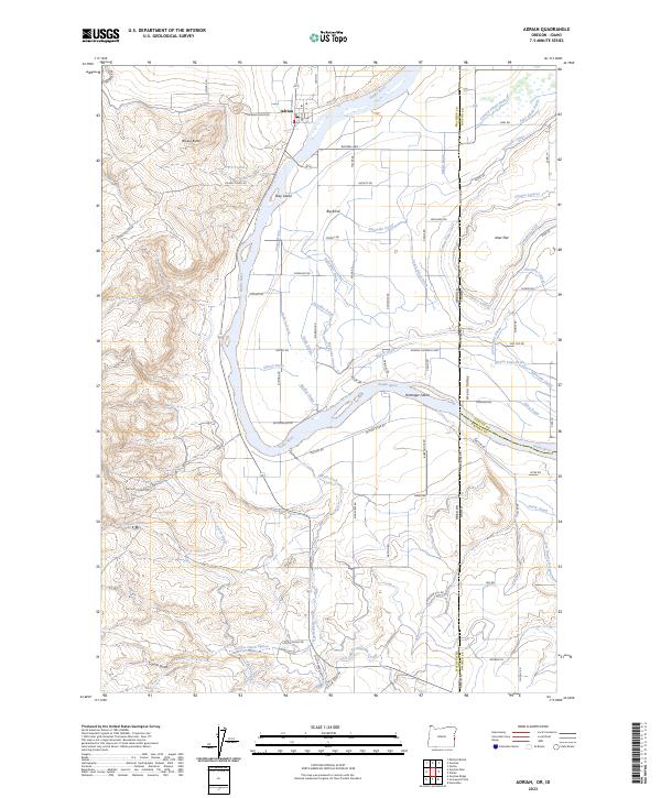
2023 Map of Adrian
USGS Topo · Published 2023About this map
The Snake River carves a winding path through this portion of the Treasure Valley, marking the boundary between Oregon and Idaho. In the northwest, the settlement of Adrian sits at the foot of Brown Butte, serving as a hub for the intricate network of irrigation canals and laterals that sustain the region's agriculture. Features like the Riverside Canal, South Canal, and Five and Seventenths Canal crisscross the landscape, illustrating the sophisticated water management systems required for farming in the high desert.
Find a feature on this map
87 named features on this map. Tap any name to fly to it.
Don’t see what you’re looking for? This feature index may not catch every label — zoom into the map to look around manually.
Map Details
Editions of this 2023 Adrian Map
This is the sole edition of this map. No revisions or reprints were ever made.
Other maps of this area

1898 · Nampa
USGS Topo · 1:125,000

1906 · Mitchell Butte
USGS Topo · 1:125,000

1955 · Boise
USGS Topo · 1:250,000

1957 · Wilder
USGS Topo · 1:24,000

1958 · Boise
USGS Topo · 1:250,000

1958 · Homedale
USGS Topo · 1:24,000

1962 · Boise
USGS Topo · 1:250,000
1965 · Parma
USGS Topo · 1:24,000
1967 · Graveyard Point
USGS Topo · 1:24,000
1967 · Owyhee Dam
USGS Topo · 1:24,000