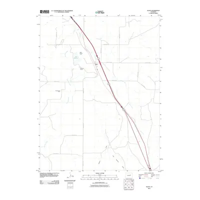
2010 Map of Agate
USGS Topo · Published 2010About this map
Agate sits as a primary corridor of travel and drainage in this high plains landscape of Elbert County. The settlement serves as a central hub for a network of rural roads, including County Rd 153 and County Rd 166, which provide access to the surrounding ranching and agricultural lands. Water management is a defining characteristic of the local geography, visible in the infrastructure of the Agate Number 1 Dam and M H Number 2 Dam, as well as the storage at Ball Reservoir. The terrain is etched by a series of intermittent waterways and drainages, most notably East Bijou Creek, Agate Creek, and the winding path of Godfrey Gulch. This 2010 survey reflects a modern view of a traditional rural crossroads, where the natural drainage patterns of Muddy Creek and its tributaries continue to dictate the placement of transportation routes and water resources.
Find a feature on this map
18 named features on this map. Tap any name to fly to it.
Don’t see what you’re looking for? This feature index may not catch every label — zoom into the map to look around manually.
Map Details
Editions of this 2010 Agate Map
This is the sole edition of this map. No revisions or reprints were ever made.
Other maps of this area

1891 · Limon
USGS Topo · 1:125,000

1892 · Limon
USGS Topo · 1:125,000

1953 · Denver
USGS Topo · 1:250,000

1954 · Limon
USGS Topo · 1:250,000

1957 · Denver
USGS Topo · 1:250,000

1957 · Limon
USGS Topo · 1:250,000

1958 · Limon
USGS Topo · 1:250,000

1958 · Denver
USGS Topo · 1:250,000

1960 · Denver
USGS Topo · 1:250,000

1968 · Deer Trail
USGS Topo · 1:24,000