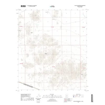
2018 Map of Agua Dulce Mountains
USGS Topo · Published 2018About this map
The Agua Dulce Mountains dominate this high-desert landscape in Pima County, situated directly along the international border as indicated by the United States of America Estados Unidos Mexicanos boundary. This 2018 survey reveals a terrain defined by stark topographical relief and critical water points such as Agua Dulce Spring and Antelope Tank. The presence of these named water features alongside dry drainage systems like San Cristobal Wash and Davidson Canyon highlights the essential nature of hydrology in this arid region. High peaks including Sheep Mtn and Papago Mtn tower over named flats and depressions like Chinaman Flat and Deer Hollow, while passage through the range is marked by the Agua Dulce Pass and Cholla Pass.
Find a feature on this map
18 named features on this map. Tap any name to fly to it.
Don’t see what you’re looking for? This feature index may not catch every label — zoom into the map to look around manually.
Map Details
Editions of this 2018 Agua Dulce Mountains Map
This is the sole edition of this map. No revisions or reprints were ever made.
Other maps of this area

1953 · Ajo
USGS Topo · 1:250,000

1954 · Sonoyta
USGS Topo · 1:250,000

1957 · Ajo
USGS Topo · 1:250,000

1958 · Ajo
USGS Topo · 1:250,000

1962 · Ajo
USGS Topo · 1:250,000

1963 · Ajo
USGS Topo · 1:250,000

1963 · Quitobaquito Springs
USGS Topo · 1:62,500

1963 · Lukeville
USGS Topo · 1:250,000
1964 · Agua Dulce Mts
USGS Topo · 1:62,500

1965 · O'Neill Hills
USGS Topo · 1:62,500