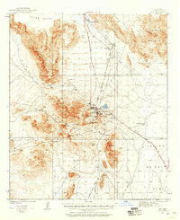
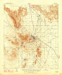
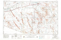
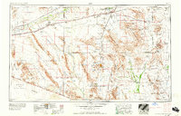
1963 Map of Ajo
USGS Topo · Published 1963About this map
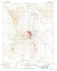
The Ajo mining district and the vast Sonoran desert landscape define this 1963 survey of southwestern Arizona. Centered on the copper-rich Ajo and the nearby settlement of Rowood, the map reveals a complex network of desert wells, ranches, and water holes essential for survival in this arid environment. The northern edge follows the Gila River and the Southern Pacific railroad corridor, while the southern reaches cross the international border into Mexico. Significant portions of the land are dedicated to federal and tribal lands, including the Papago Indian Reservation and the Organ Pipe Cactus National Monument. A unique glimpse into mid-century desert life is found in labels for O'Neils Grave and Tracy's Trading Post, marking individual human imprints upon the Tule Desert and San Cristobal Valley.
Find a feature on this map
145 named features on this map. Tap any name to fly to it.
Don’t see what you’re looking for? This feature index may not catch every label — zoom into the map to look around manually.
Map Details
Editions of this 1963 Ajo Map
This is the sole edition of this map. No revisions or reprints were ever made.
Historical Maps of Maricopa Through Time
11 maps found