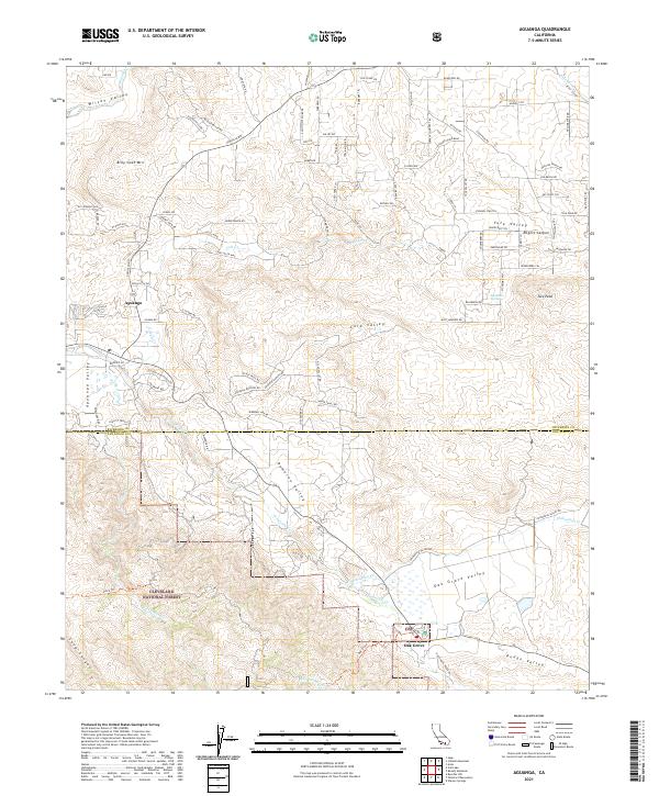
2021 Map of Aguanga
USGS Topo · Published 2021About this map
Aguanga sits at the junction of several high-desert valleys in Southern California, where the northern reaches of the Cleveland National Forest meet the rolling transition into the San Jacinto range. This 2021 survey documents the rugged landscape of Wilson Valley and Dameron Valley, where intermittent watercourses like Temecula Cr and Chihuahua Cr carve through the arid terrain. The area is defined by its network of canyon roads and backcountry trails, including the historic Old Stage Rd and the appropriately named Lost Mine Rd. Peaks such as Billy Goat Mtn and Tule Peak dominate the skyline, while the settlement of Oak Grove marks the southeastern corner of the quadrangle. The map captures a modern view of this rural interior, showing the persistence of large land tracts and named landmarks like Ruggles Ranch Rd amidst the protected forest lands.
Find a feature on this map
74 named features on this map. Tap any name to fly to it.
Don’t see what you’re looking for? This feature index may not catch every label — zoom into the map to look around manually.
Map Details
Editions of this 2021 Aguanga Map
This is the sole edition of this map. No revisions or reprints were ever made.
Other maps of this area

1901 · Southern California Sheet No. 1
USGS Topo · 1:250,000

1901 · San Jacinto
USGS Topo · 1:125,000

1903 · Ramona
USGS Topo · 1:125,000

1904 · Southern California Sheet No. 2
USGS Topo · 1:250,000

1904 · Southern California Sheet No. 1
USGS Topo · 1:250,000

1939 · Warner Springs
USGS Topo · 1:62,500

1939 · Palomar Mountain
USGS Topo · 1:62,500

1940 · Hemet Reservoir
USGS Topo · 1:62,500

1942 · Hemet Reservoir
USGS Topo · 1:62,500

1942 · Hemet
USGS Topo · 1:62,500