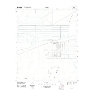
2011 Map of Aguila
USGS Topo · Published 2011About this map
Aguila stands as a focal point in the Arizona desert, characterized by its grid of local roads and a significant aviation presence including Sampleys Airport, Eagle Roost Airpark, and the Hillair Dirt Strip. The settlement is anchored by local landmarks such as the Aguila Post Office and Tom Walder Memorial Park. To the south, the terrain rises into the Harquahala Mountains and the distinct volcanic forms of Eagle Eye Mountain, which features The Eagles Beak and a Natural Arch. This landscape is defined by the management of water in an arid environment, evidenced by numerous named catchment points like Milton Ray Tank, Lapham Tank, and Goose Lake. The mapping reveals a mixture of agricultural layout, represented by Farmers Ln and Valley Rd, and the isolated Eagle Eye Ranch positioned near the desert wash system of Grass Wash.
Find a feature on this map
41 named features on this map. Tap any name to fly to it.
Don’t see what you’re looking for? This feature index may not catch every label — zoom into the map to look around manually.
Map Details
Editions of this 2011 Aguila Map
This is the sole edition of this map. No revisions or reprints were ever made.
Other maps of this area

1923 · Signal
USGS Topo · 1:250,000

1942 · Signal
USGS Topo · 1:250,000

1942 · Vicksburg
USGS Topo · 1:250,000

1950 · Prescott
USGS Topo · 1:250,000

1954 · Prescott
USGS Topo · 1:250,000

1954 · Phoenix
USGS Topo · 1:250,000

1957 · Phoenix
USGS Topo · 1:250,000

1958 · Prescott
USGS Topo · 1:250,000

1958 · Phoenix
USGS Topo · 1:250,000

1959 · Prescott
USGS Topo · 1:250,000