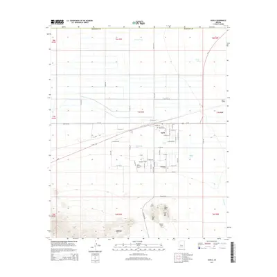
2014 Map of Aguila
USGS Topo · Published 2014About this map
Aguila stands as a central hub in the north-central part of this 2014 survey, where the grid of desert roads meets Us-60 and Az-71. The settlement's community layout is anchored by Tom Walder Memorial Park and surrounded by numerous small airfields, including Sampley's Airport, Eagle Roost Airpark, and the Hillair Dirt Strip-Airport, indicating the importance of general aviation in the Aguila Valley.
Find a feature on this map
56 named features on this map. Tap any name to fly to it.
Don’t see what you’re looking for? This feature index may not catch every label — zoom into the map to look around manually.
Map Details
Editions of this 2014 Aguila Map
This is the sole edition of this map. No revisions or reprints were ever made.
Other maps of this area

1923 · Signal
USGS Topo · 1:250,000

1942 · Signal
USGS Topo · 1:250,000

1942 · Vicksburg
USGS Topo · 1:250,000

1950 · Prescott
USGS Topo · 1:250,000

1954 · Prescott
USGS Topo · 1:250,000

1954 · Phoenix
USGS Topo · 1:250,000

1957 · Phoenix
USGS Topo · 1:250,000

1958 · Prescott
USGS Topo · 1:250,000

1958 · Phoenix
USGS Topo · 1:250,000

1959 · Prescott
USGS Topo · 1:250,000