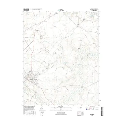
2016 Map of Ahoskie
USGS Topo · Published 2016About this map
The town of Ahoskie sits at the southwestern edge of this landscape, its grid of streets framed by the elevated Ahoskie Ridge and the winding course of Ahoskie Creek. The surrounding territory in northeastern North Carolina is characterized by extensive wetlands and drainage systems, notably the Ahoskie Swamp and Whiteoak Swamp, which dominate the eastern and southern portions of the sheet. These natural features shaped the settlement pattern, pushing communities like Pleasant Plains, California, and Cofield toward higher ground.
Find a feature on this map
109 named features on this map. Tap any name to fly to it.
Don’t see what you’re looking for? This feature index may not catch every label — zoom into the map to look around manually.
Map Details
Editions of this 2016 Ahoskie Map
This is the sole edition of this map. No revisions or reprints were ever made.
Other maps of this area

1908 · Winton
USGS Topo · 1:62,500

1953 · Norfolk
USGS Topo · 1:250,000

1972 · Aulander
USGS Topo · 1:24,000
1973 · Murfreesboro
USGS Topo · 1:24,000

1977 · Union
USGS Topo · 1:24,000
1981 · Gatesville
USGS Topo · 1:24,000

1982 · Powellsville
USGS Topo · 1:24,000
1982 · Winton
USGS Topo · 1:24,000
1982 · Colerain
USGS Topo · 1:24,000
1982 · Harrellsville
USGS Topo · 1:24,000