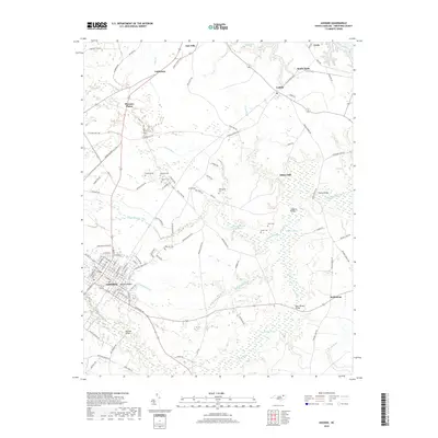
2019 Map of Ahoskie
USGS Topo · Published 2019About this map
Ahoskie serves as the regional hub for this part of Hertford County, situated amidst a landscape defined by extensive wetlands like Ahoskie Swamp and Whiteoak Swamp. The town grid, including the neighborhoods of Ahoskie Ridge, gives way to a network of rural roads that connect smaller outlying settlements such as Pleasant Plains, Cofield, and Bethlehem. This 2019 survey documents a dense concentration of family cemeteries, including Brinkley Cem, Brantley Cem, and Weaver Cem, which are invaluable for genealogical research into the local farming families of the area.
Find a feature on this map
109 named features on this map. Tap any name to fly to it.
Don’t see what you’re looking for? This feature index may not catch every label — zoom into the map to look around manually.
Map Details
Editions of this 2019 Ahoskie Map
This is the sole edition of this map. No revisions or reprints were ever made.
Other maps of this area

1908 · Winton
USGS Topo · 1:62,500

1953 · Norfolk
USGS Topo · 1:250,000

1972 · Aulander
USGS Topo · 1:24,000
1973 · Murfreesboro
USGS Topo · 1:24,000

1977 · Union
USGS Topo · 1:24,000
1981 · Gatesville
USGS Topo · 1:24,000

1982 · Powellsville
USGS Topo · 1:24,000
1982 · Winton
USGS Topo · 1:24,000
1982 · Colerain
USGS Topo · 1:24,000
1982 · Harrellsville
USGS Topo · 1:24,000