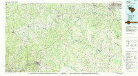
1983 Map of Aiken
USGS Topo · Published 1984About this map
The Savannah River corridor and the expansive South Carolina sandhills define this landscape in the early 1980s. Centered on Aiken, the map details a region where long-standing textile and industrial communities like Graniteville, Langley, and Warrenville line the Horse Creek valley. To the north and west, the terrain shifts into the timberlands of Sumter National Forest and the Taylor Tree Nursery State Forest, while the northeastern quadrant reaches toward the suburbs of Columbia.
Find a feature on this map
133 named features on this map. Tap any name to fly to it.
Don’t see what you’re looking for? This feature index may not catch every label — zoom into the map to look around manually.
Map Details
Editions of this 1983 Aiken Map
This is the sole edition of this map. No revisions or reprints were ever made.
Other maps of this area

1892 · Mc Cormick
USGS Topo · 1:125,000

1892 · Abbeville
USGS Topo · 1:125,000

1904 · Columbia
USGS Topo · 1:125,000

1908 · Kirksey
USGS Topo · 1:24,000

1912 · Mc Cormick
USGS Topo · 1:125,000

1919 · Bamberg
USGS Topo · 1:48,000

1920 · Bamberg
USGS Topo · 1:62,500

1920 · Aiken
USGS Topo · 1:48,000

1920 · Orangeburg
USGS Topo · 1:48,000

1920 · Talatha
USGS Topo · 1:48,000