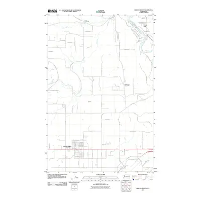
2011 Map of Airway Heights
USGS Topo · Published 2011About this map
Airway Heights anchors the southern portion of this landscape, showing a dense street grid of residential and commercial corridors just west of Hazelwood. The area north of the city transitions into a more rural settlement pattern, where the historic Lyons and Highland locales are situated along a network of section-line roads. In the northeast, the terrain drops significantly toward the Spokane River and the Nine Mile Reservoir, a rugged area preserved within Riverside State Park. Local civic life is marked by the Stevens Township Hall in the northern reaches near Coulee Creek. The drainage patterns of Deep Creek and its tributaries carve across the central plains, illustrating the geographic transition from the plateau down to the river valley in the early 21st century.
Find a feature on this map
49 named features on this map. Tap any name to fly to it.
Don’t see what you’re looking for? This feature index may not catch every label — zoom into the map to look around manually.
Map Details
Editions of this 2011 Airway Heights Map
This is the sole edition of this map. No revisions or reprints were ever made.
Other maps of this area

1901 · Spokane
USGS Topo · 1:125,000

1943 · Medical Lake
USGS Topo · 1:62,500

1944 · Clayton
USGS Topo · 1:62,500

1949 · Deer Park
USGS Topo · 1:62,500

1950 · Spokane SW
USGS Topo · 1:24,000

1950 · Spokane NW
USGS Topo · 1:24,000

1950 · Spokane
USGS Topo · 1:62,500

1950 · Clayton
USGS Topo · 1:62,500

1951 · Deer Park
USGS Topo · 1:62,500

1954 · Airway Heights
USGS Topo · 1:24,000