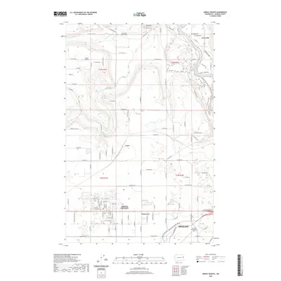
2020 Map of Airway Heights
USGS Topo · Published 2020About this map
Airway Heights serves as a focal point for this eastern Washington landscape, situated on the high plateau just west of the Spokane city limits. The geography is defined by the sharp descent from the plateau into the Spokane River valley, where the Seven Mile Road Bridge crosses the water near the settlement of Seven Mile. To the north, the terrain transitions into the open spaces of Indian Prairie and the distinctive geological features of Pine Bluff and the Horse Corridor. The southern portion of the map is dominated by the expansive infrastructure of the Spokane International Airport, illustrating the modern transport network that replaced early rural settlements like Lyons and Hazelwood. The drainage patterns of Coulee Cr and Deep Cr cut through the northern volcanic and glacial deposits, providing a look at the natural hydrology that shaped the area's development.
Find a feature on this map
67 named features on this map. Tap any name to fly to it.
Don’t see what you’re looking for? This feature index may not catch every label — zoom into the map to look around manually.
Map Details
Editions of this 2020 Airway Heights Map
This is the sole edition of this map. No revisions or reprints were ever made.
Other maps of this area

1901 · Spokane
USGS Topo · 1:125,000

1943 · Medical Lake
USGS Topo · 1:62,500

1944 · Clayton
USGS Topo · 1:62,500

1949 · Deer Park
USGS Topo · 1:62,500

1950 · Spokane SW
USGS Topo · 1:24,000

1950 · Spokane NW
USGS Topo · 1:24,000

1950 · Spokane
USGS Topo · 1:62,500

1950 · Clayton
USGS Topo · 1:62,500

1951 · Deer Park
USGS Topo · 1:62,500

1954 · Airway Heights
USGS Topo · 1:24,000