
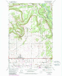
1973 Map of Airway Heights
USGS Topo · Published 1975About this map
Fairchild Air Force Base and the Spokane International Airport dominate the southern landscape of this 1973 survey, illustrating the significant aviation and military footprint on the outskirts of Spokane. The city of Airway Heights sits between these major hubs, while the northern terrain transitions into the steep coulees of Deep Creek and the sweeping curves of the Spokane River. The presence of Riverside State Park and the Camp Seven Mile Military Reservation highlights a corridor preserved for both public recreation and military utility.
Find a feature on this map
54 named features on this map. Tap any name to fly to it.
Don’t see what you’re looking for? This feature index may not catch every label — zoom into the map to look around manually.
Map Details
Editions of this 1973 Airway Heights Map
2 editions found
Other maps of this area

1901 · Spokane
USGS Topo · 1:125,000

1943 · Medical Lake
USGS Topo · 1:62,500

1944 · Clayton
USGS Topo · 1:62,500

1949 · Deer Park
USGS Topo · 1:62,500

1950 · Spokane SW
USGS Topo · 1:24,000

1950 · Spokane NW
USGS Topo · 1:24,000

1950 · Spokane
USGS Topo · 1:62,500

1950 · Clayton
USGS Topo · 1:62,500

1951 · Deer Park
USGS Topo · 1:62,500

1954 · Airway Heights
USGS Topo · 1:24,000