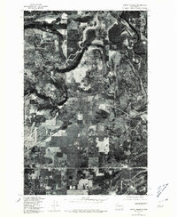
1978 Map of Airway Heights
USGS Topo · Published 1981About this map
Airway Heights appears in this orthophotoquad as a growing geometric grid of development amidst the broad, open flats of eastern Washington. The aerial imagery captures a distinct transition between the concentrated settlement of the town and the sprawling agricultural and natural terrain nearby. To the north, the winding, deeply incised river valley cuts through the landscape, creating a stark contrast to the level expanses of Indian Prairie and the elevated terrain of Highland. The small community of Lyons is visible along the primary transportation route, serving as a secondary focal point in a region defined by its flat-topped mesas and strategic proximity to Spokane. This survey provides a precise visual record of land use and vegetation patterns just before the rapid late-century expansion of the Inland Northwest.
Find a feature on this map
5 named features on this map. Tap any name to fly to it.
Don’t see what you’re looking for? This feature index may not catch every label — zoom into the map to look around manually.
Map Details
Editions of this 1978 Airway Heights Map
This is the sole edition of this map. No revisions or reprints were ever made.
Other maps of this area

1901 · Spokane
USGS Topo · 1:125,000

1943 · Medical Lake
USGS Topo · 1:62,500

1944 · Clayton
USGS Topo · 1:62,500

1949 · Deer Park
USGS Topo · 1:62,500

1950 · Spokane SW
USGS Topo · 1:24,000

1950 · Spokane NW
USGS Topo · 1:24,000

1950 · Spokane
USGS Topo · 1:62,500

1950 · Clayton
USGS Topo · 1:62,500

1951 · Deer Park
USGS Topo · 1:62,500

1954 · Airway Heights
USGS Topo · 1:24,000