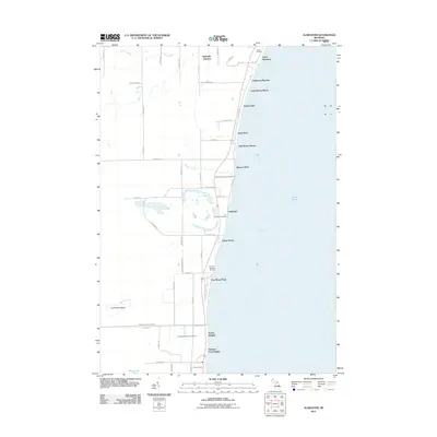
2011 Map of Alabaster
USGS Topo · Published 2011About this map
The U S Gypsum Company defines the industrial landscape of this Lake Huron coastal region, where mining infrastructure meets the shoreline of Saginaw Bay. The settlement of Alabaster and its nearby Alabaster Township Cemetery anchor a community established around the gypsum deposits, with a network of specialized drainage systems like the Alabaster Whitney Drain and Ray Drain managing the local hydrology.
Find a feature on this map
58 named features on this map. Tap any name to fly to it.
Don’t see what you’re looking for? This feature index may not catch every label — zoom into the map to look around manually.
Map Details
Editions of this 2011 Alabaster Map
This is the sole edition of this map. No revisions or reprints were ever made.
Other maps of this area

1954 · Tawas City
USGS Topo · 1:250,000

1958 · Tawas City
USGS Topo · 1:250,000

1959 · Tawas City
USGS Topo · 1:62,500

1959 · East Tawas
USGS Topo · 1:62,500

1966 · Point Lookout
USGS Topo · 1:24,000

1966 · Au Gres
USGS Topo · 1:24,000

1966 · Alabaster
USGS Topo · 1:24,000

1966 · National City
USGS Topo · 1:24,000
1970 · Charity Island
USGS Topo · 1:24,000

1984 · Tawas City
USGS Topo · 1:100,000