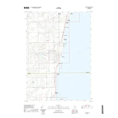
2019 Map of Alabaster
USGS Topo · Published 2019About this map
The Lake Huron coastline defines this landscape, where residential developments like Lake Huron Beach, Huron Oaks, and Hyde Park line the shore north of Alabaster. This community, historically significant for its gypsum deposits, remains a focal point of the region. The map details the local infrastructure supporting these coastal settlements, including Alabaster Rd and Gypsum Rd, which lead inland toward the wetlands of Kendall Marsh and Crowell Swamp.
Find a feature on this map
60 named features on this map. Tap any name to fly to it.
Don’t see what you’re looking for? This feature index may not catch every label — zoom into the map to look around manually.
Map Details
Editions of this 2019 Alabaster Map
This is the sole edition of this map. No revisions or reprints were ever made.
Other maps of this area

1954 · Tawas City
USGS Topo · 1:250,000

1958 · Tawas City
USGS Topo · 1:250,000

1959 · Tawas City
USGS Topo · 1:62,500

1959 · East Tawas
USGS Topo · 1:62,500

1966 · Point Lookout
USGS Topo · 1:24,000

1966 · Au Gres
USGS Topo · 1:24,000

1966 · Alabaster
USGS Topo · 1:24,000

1966 · National City
USGS Topo · 1:24,000
1970 · Charity Island
USGS Topo · 1:24,000

1984 · Tawas City
USGS Topo · 1:100,000