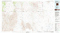
1983 Map of Alamo Hueco Mountains
USGS Topo · Published 1983About this map
The Continental Divide winds through the high desert of the borderlands, marking a landscape defined by the Alamo Hueco Mountains and the San Luis Mountains. This 1983 survey provides a detailed view of the international boundary between New Mexico and Mexico, specifically highlighting the Antelope Wells Port of Entry and the neighboring settlement of El Berrendo. The map shows a region of cattle ranching and remote outposts, where seasonal drainages like Animas Creek and Deer Creek feed into broad basins such as the Animas Valley and Playas Valley. Land use is primarily agricultural and conservation-oriented, including the Coronado National Forest and the Big Hatchet State Game Refuge. In the southern half of the map, Mexican locales such as San Francisco and Rancho Nuevo are situated near the waters of the Rio Casas Grandes, reflecting the shared hydrological and social character of the Chihuahuan Desert region across the border.
Find a feature on this map
138 named features on this map. Tap any name to fly to it.
Don’t see what you’re looking for? This feature index may not catch every label — zoom into the map to look around manually.
Map Details
Editions of this 1983 Alamo Hueco Mountains Map
This is the sole edition of this map. No revisions or reprints were ever made.
Other maps of this area

1917 · Chiricahua
USGS Topo · 1:125,000

1917 · Antelope Wells
USGS Topo · 1:62,500

1918 · Big Hatchet Peak
USGS Topo · 1:62,500

1918 · Dog Mountains
USGS Topo · 1:62,500

1918 · Walnut Wells
USGS Topo · 1:62,500

1918 · Cienega Springs
USGS Topo · 1:62,500

1918 · Animas Peak
USGS Topo · 1:62,500

1919 · Antelope Wells
USGS Topo · 1:62,500

1919 · Perilla
USGS Topo · 1:125,000

1919 · Chiricahua
USGS Topo · 1:125,000