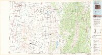
1983 Map of Alamosa
USGS Topo · Published 1983About this map
The Rio Grande and the Denver and Rio Grande Western railroad corridor anchor this 1980s landscape, illustrating the agricultural and transit infrastructure of the San Luis Valley. To the east, the dramatic rise of the Sangre de Cristo Mountains and the Culebra Range creates a sharp vertical boundary against the high-altitude basin. A distinct subdivision road pattern is etched into the terrain near the San Pedro Mesa, reflecting twentieth-century land development efforts in this arid environment.
Find a feature on this map
140 named features on this map. Tap any name to fly to it.
Don’t see what you’re looking for? This feature index may not catch every label — zoom into the map to look around manually.
Map Details
Editions of this 1983 Alamosa Map
2 editions found
Other maps of this area

1889 · Huerfano Park
USGS Topo · 1:125,000

1891 · Walsenburg
USGS Topo · 1:125,000

1891 · Spanish Peaks
USGS Topo · 1:125,000

1892 · Huerfano Park
USGS Topo · 1:125,000

1893 · Spanish Peaks
USGS Topo · 1:125,000

1894 · Walsenburg
USGS Topo · 1:125,000

1895 · Spanish Peaks
USGS Topo · 1:125,000

1897 · Walsenburg
USGS Topo · 1:125,000

1897 · Spanish Peaks
USGS Topo · 1:125,000

1900 · Spanish Peaks
USGS Topo · 1:125,000