
Historical Maps of Las Animas County, Colorado
What stories do these 401 old maps tell about Las Animas County's past? From 1891 to present day, these maps reveal the evolution of streets, neighborhoods, iconic landmarks, and natural features in stunning high-res detail. Whether you're a history enthusiast, genealogist, or professional in education, environmental work, or architecture, these maps are perfect for exploration, research, and discovery.
Discover Las Animas County's history through maps:
- Trace Las Animas County's growth: Explore earlier and latest maps and editions to uncover how the region changed over time.
- Examine technical details: Each map includes its creators, publishers, scale, dimensions, and full source information.
- Layer maps with modern tools & imagery: Compare historical maps to modern-day with high-resolution satellite imagery and detailed LiDAR layers.
- Sourced from trusted archives: Carefully preserved and digitized by institutions like the United Stated Geological Survey and the US Library of Congress.
- Access in any format: View and explore in high resolution, download for offline use, or order a museum-quality print for yourself or a loved one.
Begin your journey into Las Animas County's history with these remarkable must-see maps.
Las Animas County, CO maps
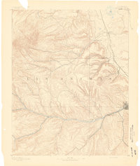
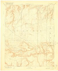
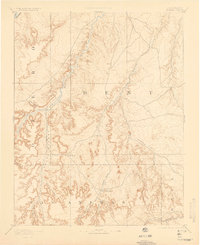
(401)- 1891 Map of Walsenburg
 1891 Walsenburg1891 Print · USGSCovers Las Animas County, including Walsenburg, Colorado City, and other nearby areas
 - 1891 Map of Higbee
 1891 Higbee1891 Print · USGSCovers Las Animas County, including Gilpin, Ruxton, and other nearby areas
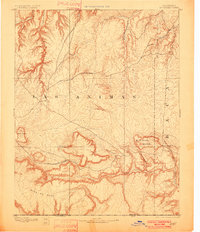
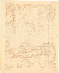
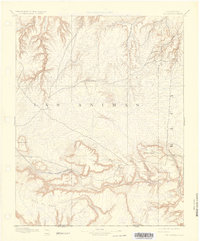
 - 1891 Map of Spanish Peaks
 1891 Spanish Peaks1891 Print · USGSCovers Las Animas County, including Trinidad, Aguilar, and other nearby areas
 - 1891 Map of Timpas
 1891 Timpas1891 Print · USGSCovers Las Animas County, including La Junta, Ormega, and other nearby areas
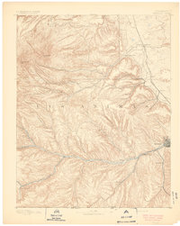
 - 1891 Map of Apishapa
 1891 Apishapa1891 Print · USGSCovers Las Animas County, including Rock Crossing, Whiterock, and other nearby areas
 - 1891 Map of Trinidad
 1891 Trinidad1891 Print · USGSCovers Las Animas County, including Trinidad, Aguilar, and other nearby areas
 - 1891 Map of Mesa De Maya
 1891 Mesa De Maya1891 Print · USGSCovers Las Animas County, including Branson, Villegreen, and other nearby areas
 - 1892 Map of Elmoro
 1892 Elmoro1892 Print · USGSCovers Las Animas County, including Trinidad, Abeyta, and other nearby areas
 - 1892 Map of Mt Carrizo
 1892 Mt Carrizo1892 Print · USGSCovers Las Animas County, including Kim, Utleyville, and other nearby areas
 - 1892 Map of Mt Carrizo, 1901 Print
 1892 Mt Carrizo1901 Print · USGSCovers Las Animas County, including Kim, Utleyville, and other nearby areas
 - 1892 Map of Mt Carrizo, 1901 Print
 1892 Mt Carrizo1901 Print · USGSCovers Las Animas County, including Kim, Utleyville, and other nearby areas
 - 1892 Map of Mt Carrizo, 1912 Print
 1892 Mt Carrizo1912 Print · USGSCovers Las Animas County, including Kim, Utleyville, and other nearby areas
 - 1892 Map of Mt Carrizo, 1916 Print
 1892 Mt Carrizo1916 Print · USGSCovers Las Animas County, including Kim, Utleyville, and other nearby areas
 - 1892 Map of Mt Carrizo, 1927 Print
 1892 Mt Carrizo1927 Print · USGSCovers Las Animas County, including Kim, Utleyville, and other nearby areas
 - 1892 Map of Mount Carrizo, 1949 Print
 1892 Mount Carrizo1949 Print · USGSCovers Las Animas County, including Kim, Utleyville, and other nearby areas
 - 1893 Map of Trinidad
 1893 Trinidad1893 Print · USGSCovers Las Animas County, including Trinidad, Aguilar, and other nearby areas
 - 1893 Map of Higbee
 1893 Higbee1893 Print · USGSCovers Las Animas County, including Gilpin, Ruxton, and other nearby areas
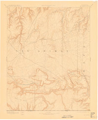
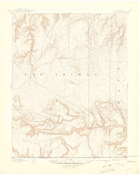
 - 1893 Map of Spanish Peaks
 1893 Spanish Peaks1893 Print · USGSCovers Las Animas County, including Trinidad, Aguilar, and other nearby areas
 - 1893 Map of Apishapa
 1893 Apishapa1893 Print · USGSCovers Las Animas County, including Rock Crossing, Whiterock, and other nearby areas
 - 1893 Map of Elmoro
 1893 Elmoro1893 Print · USGSCovers Las Animas County, including Trinidad, Abeyta, and other nearby areas
 - 1893 Map of Mesa de Maya
 1893 Mesa de Maya1893 Print · USGSCovers Las Animas County, including Branson, Villegreen, and other nearby areas
 - 1893 Map of Mesa De Maya, 1896 Print
 1893 Mesa De Maya1896 Print · USGSCovers Las Animas County, including Branson, Villegreen, and other nearby areas
 - 1893 Map of Higbee, 1898 Print
 1893 Higbee1898 Print · USGSCovers Las Animas County, including Gilpin, Ruxton, and other nearby areas
 - 1893 Map of Mesa De Maya, 1901 Print
 1893 Mesa De Maya1901 Print · USGSCovers Las Animas County, including Branson, Villegreen, and other nearby areas
 - 1893 Map of Higbee, 1902 Print
 1893 Higbee1902 Print · USGSCovers Las Animas County, including Gilpin, Ruxton, and other nearby areas
Showing maps 1-25 of 401
Top cities in Las Animas County
- Trinidad historical maps
- Aguilar historical maps
- Cokedale historical maps
- Kim historical maps
- Branson historical maps
- Starkville historical maps
Frequently asked questions
- What are the different types of historical maps available for Las Animas County?
- What is the oldest map of Las Animas County?
- Where can I purchase historical maps of Las Animas County for my home or office?
- Where can I download high-res historical maps of Las Animas County?
- Are there historical topographic maps available for Las Animas County?
- Is there historical aerial imagery available for Las Animas County?
- Where are historical maps of Las Animas County sourced from?