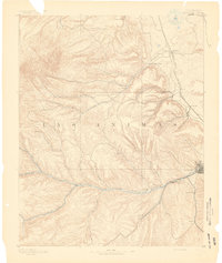
1893 Map of Trinidad
USGS Topo · Published 1893About this map
Trinidad serves as the focal point of this late-19th-century landscape, where the southern plains meet the Sangre de Cristo foothills. The Purgatoire River carves a critical path through the terrain, flanked by early coal-mining settlements and railroad stops like Starkville, Sopris, and Morley. The economic infrastructure of the era is anchored by the Denver, Texas and Fort Worth Railroad, which snakes through the eastern corridor past Schultze Plaza and Chicosa. To the northwest, the dual summits of East Spanish Peak and West Spanish Peak dominate the skyline, while the network of canyons, including Chicosa Canyon and Reilly Canyon, reveals the complex drainage patterns feeding into the Apishapa River system. This 1893 edition documents a region in transition, capturing ranching outposts and mining hamlets along the Colorado New Mexico Boundary Line before the turn of the century.
Find a feature on this map
36 named features on this map. Tap any name to fly to it.
Don’t see what you’re looking for? This feature index may not catch every label — zoom into the map to look around manually.
Map Details
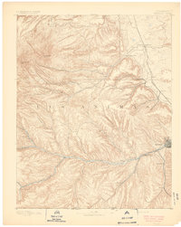
Editions of this 1893 Trinidad Map
2 editions found

Historical Maps of Trinidad Through Time
8 maps found