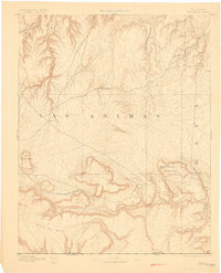
1892 Map of Mt Carrizo
USGS Topo · Published 1901About this map
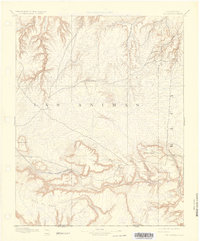
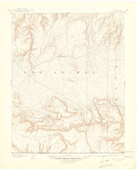
The canyonlands of southeastern Colorado appear here as they were documented during an 1890 survey by topographer Willard D. Johnson. This high plains landscape is dominated by the dramatic relief of the Mesa De Maya and the prominent Mount Carrizo, where Carrizo Springs provided a critical water source in an otherwise arid territory. The drainage patterns of West Carrizo Creek and Two Butte Creek illustrate the erosional forces that shaped the Nonsmoking Canyon in the northwest corner of the sheet.
Find a feature on this map
17 named features on this map. Tap any name to fly to it.
Don’t see what you’re looking for? This feature index may not catch every label — zoom into the map to look around manually.
Map Details
Editions of this 1892 Mt Carrizo Map
7 editions found
Other maps of this area

1891 · Higbee
USGS Topo · 1:125,000

1891 · Timpas
USGS Topo · 1:125,000

1891 · Springfield
USGS Topo · 1:125,000

1891 · Mesa De Maya
USGS Topo · 1:125,000

1892 · Two Butte
USGS Topo · 1:125,000

1892 · Mt Carrizo
USGS Topo · 1:125,000

1893 · Higbee
USGS Topo · 1:125,000

1893 · Two Butte
USGS Topo · 1:125,000

1893 · Springfield
USGS Topo · 1:125,000

1893 · Mesa de Maya
USGS Topo · 1:125,000