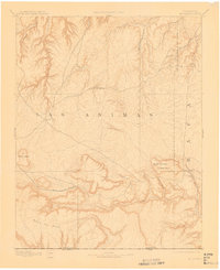
1892 Map of Mt Carrizo
USGS Topo · Published 1912About this map
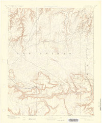
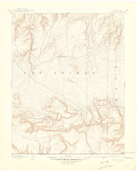
Mount Carrizo and the surrounding high plains of southeastern Colorado are captured in this reconnaissance survey, conducted just before the turn of the century. The landscape is defined by its dramatic relief, where the flat tops of Fowler Mesa and the expansive Mesa De Maya drop into deep drainage networks. The water-scarce nature of Las Animas County is evident in the reliance on landmarks like Willow Spring and Carrizo Springs, which served as critical resources for early travelers and ranchers. The map traces the rugged path of West Carrizo Creek and East Carrizo Creek as they cut through the terrain. The presence of Potato Butte provides a distinct navigational marker in this sparsely settled region, where the state boundary with New Mexico is clearly delineated along the southern edge.
Find a feature on this map
19 named features on this map. Tap any name to fly to it.
Don’t see what you’re looking for? This feature index may not catch every label — zoom into the map to look around manually.
Map Details
Editions of this 1892 Mt Carrizo Map
7 editions found
Other maps of this area

1891 · Higbee
USGS Topo · 1:125,000

1891 · Timpas
USGS Topo · 1:125,000

1891 · Springfield
USGS Topo · 1:125,000

1891 · Mesa De Maya
USGS Topo · 1:125,000

1892 · Two Butte
USGS Topo · 1:125,000

1892 · Mt Carrizo
USGS Topo · 1:125,000

1893 · Higbee
USGS Topo · 1:125,000

1893 · Two Butte
USGS Topo · 1:125,000

1893 · Springfield
USGS Topo · 1:125,000

1893 · Mesa de Maya
USGS Topo · 1:125,000