1892 Map of Mount Carrizo
USGS Topo · Published 1949About this map
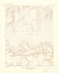
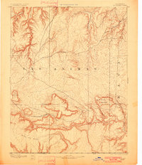
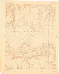
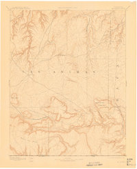
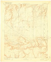
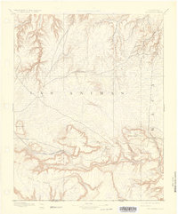
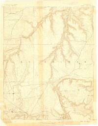
Pinon Canyon dominates the northwestern portion of this 1890s survey, illustrating the complex drainage patterns of the high plains along the border between Las Animas and Baca counties. The landscape is defined by its watercourses, which served as vital landmarks for early ranchers and travelers in this corner of Colorado. To the north, Two Butte Creek and Mustard Creek carve through the terrain, while the southern reaches are marked by the converging paths of West Carrizo Creek and East Carrizo Creek. This reconnaissance-style mapping shows the topography as it was understood before significant modern development, emphasizing the natural draws like Freezeout Creek that dictated the placement of early routes and homesteads in a region where water was the primary driver of settlement.
Find a feature on this map
8 named features on this map. Tap any name to fly to it.
Don’t see what you’re looking for? This feature index may not catch every label — zoom into the map to look around manually.
Map Details
Editions of this 1892 Mount Carrizo Map
7 editions found
Other maps of this area

1891 · Higbee
USGS Topo · 1:125,000

1891 · Timpas
USGS Topo · 1:125,000

1891 · Springfield
USGS Topo · 1:125,000

1891 · Mesa De Maya
USGS Topo · 1:125,000

1892 · Two Butte
USGS Topo · 1:125,000

1892 · Mt Carrizo
USGS Topo · 1:125,000

1893 · Higbee
USGS Topo · 1:125,000

1893 · Two Butte
USGS Topo · 1:125,000

1893 · Springfield
USGS Topo · 1:125,000
1893 · Mesa de Maya
USGS Topo · 1:125,000