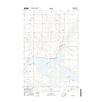
2017 Map of Alanson
USGS Topo · Published 2017About this map
The northern tip of Michigan’s Lower Peninsula centers on the Inland Waterway, a series of navigable lakes and rivers including Crooked Lake and Pickerel Lake. The village of Alanson serves as a critical junction where the Crooked River flows toward the larger Great Lakes system, while the surrounding landscape is marked by the shoreline settlements of Oden, Ponshewaing, and Conway. This 2017 survey reveals the area's complex social history through its burial grounds, including the Sacramentine Monastery Cem and the Emmet County Poor Farm Cem, which speaks to the historical care for the indigent in Emmet County. Terrain features like Graham Point and Indiana Point define the convoluted shoreline, while the upland areas near Ayr and Brutus are crisscrossed by rural routes such as E Brutus Rd and Valley Rd. The presence of the Mennonite Cem further reflects the diverse cultural and religious heritage that shaped the Littlefield Township region.
Find a feature on this map
107 named features on this map. Tap any name to fly to it.
Don’t see what you’re looking for? This feature index may not catch every label — zoom into the map to look around manually.
Map Details
Editions of this 2017 Alanson Map
This is the sole edition of this map. No revisions or reprints were ever made.
Other maps of this area

1955 · Cheboygan
USGS Topo · 1:250,000

1957 · Wolverine
USGS Topo · 1:62,500

1957 · Mullett Lake
USGS Topo · 1:62,500

1958 · Cheboygan
USGS Topo · 1:250,000

1958 · Pellston
USGS Topo · 1:62,500

1958 · Petoskey
USGS Topo · 1:62,500

1975 · Petoskey NW
USGS Topo · 1:24,000

1975 · Petoskey SW
USGS Topo · 1:24,000

1975 · Petoskey NE
USGS Topo · 1:24,000

1982 · Petoskey
USGS Topo · 1:100,000
Featured Places
- Alanson, MI
- Bear Creek Township, MI
- Littlefield Township, MI
- Pleasantview Township, MI
- Maple River Township, MI