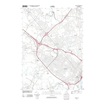
2010 Map of Albany
USGS Topo · Published 2010About this map
The capital city of Albany is depicted here at the intersection of major transport corridors and historical settlements. The landscape is defined by the Hudson River and the winding course of Normans Kill as they frame the urban and suburban development of the early 21st century. Significant institutional grounds occupy large tracts of land, most notably the University at Albany, State University of New York and the sprawling Albany County Airport to the north.
Find a feature on this map
66 named features on this map. Tap any name to fly to it.
Don’t see what you’re looking for? This feature index may not catch every label — zoom into the map to look around manually.
Map Details
Editions of this 2010 Albany Map
This is the sole edition of this map. No revisions or reprints were ever made.
Other maps of this area

1893 · Cohoes
USGS Topo · 1:62,500

1893 · Troy
USGS Topo · 1:62,500

1893 · Schenectady
USGS Topo · 1:62,500

1893 · Albany
USGS Topo · 1:62,500

1895 · Troy
USGS Topo · 1:62,500

1895 · Cohoes
USGS Topo · 1:62,500

1895 · Albany
USGS Topo · 1:62,500

1895 · Schenectady
USGS Topo · 1:62,500

1898 · Schenectady
USGS Topo · 1:62,500

1898 · Albany
USGS Topo · 1:62,500