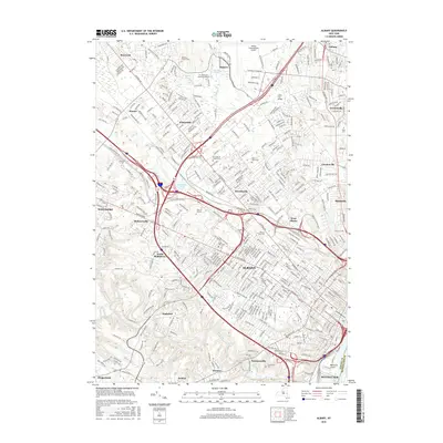
2016 Map of Albany
USGS Topo · Published 2016About this map
The capital city of Albany is depicted here as a dense urban and suburban landscape, defined by a complex network of highways and deep-seated institutional landmarks. Educational centers like SUNY at Albany and Siena Coll occupy large footprints on the city’s periphery, while older burial grounds such as Memorys Garden Cem and Saint Johns Cem provide historical continuity for genealogical research. The map captures the significant transit infrastructure of the region, including the Albany International Airport in the north and the Collar City Bridge crossing the Hudson River toward Rensselaer. Waterways like Normans Kill and the Krum Kill wind through the more residential southern and western sections, contrasting with the industrial corridors and rail lines managed by the CSX railroad. From the suburban reaches of Colonie to the tight-knit grid of the city center, the sheet shows the 21st-century evolution of New York's political hub.
Find a feature on this map
370 named features on this map. Tap any name to fly to it.
Don’t see what you’re looking for? This feature index may not catch every label — zoom into the map to look around manually.
Map Details
Editions of this 2016 Albany Map
This is the sole edition of this map. No revisions or reprints were ever made.
Other maps of this area

1893 · Cohoes
USGS Topo · 1:62,500

1893 · Troy
USGS Topo · 1:62,500

1893 · Schenectady
USGS Topo · 1:62,500

1893 · Albany
USGS Topo · 1:62,500

1895 · Troy
USGS Topo · 1:62,500

1895 · Cohoes
USGS Topo · 1:62,500

1895 · Albany
USGS Topo · 1:62,500

1895 · Schenectady
USGS Topo · 1:62,500

1898 · Schenectady
USGS Topo · 1:62,500

1898 · Albany
USGS Topo · 1:62,500