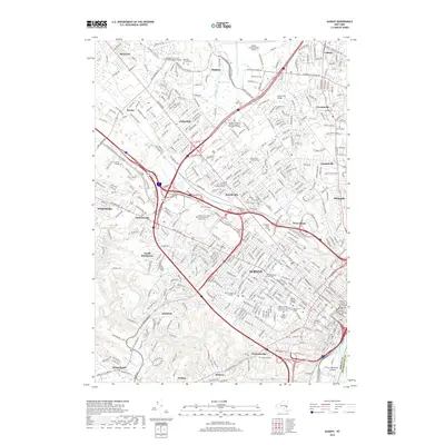
2019 Map of Albany
USGS Topo · Published 2019About this map
Albany serves as the focal point of this 2019 survey, showing a landscape defined by state government, higher education, and an intricate suburban network. The expansive campus of the University at Albany State University of New York dominates the central portion of the sheet, while the dense city core reveals the Albany County Courthouse and Albany County Judicial Center. This modern topographical record shows the heavy footprint of the Adirondack Northway and Central Ave as they cut through established neighborhoods like Roessleville and West Albany.
Find a feature on this map
57 named features on this map. Tap any name to fly to it.
Don’t see what you’re looking for? This feature index may not catch every label — zoom into the map to look around manually.
Map Details
Editions of this 2019 Albany Map
This is the sole edition of this map. No revisions or reprints were ever made.
Other maps of this area

1893 · Cohoes
USGS Topo · 1:62,500

1893 · Troy
USGS Topo · 1:62,500

1893 · Schenectady
USGS Topo · 1:62,500

1893 · Albany
USGS Topo · 1:62,500

1895 · Troy
USGS Topo · 1:62,500

1895 · Cohoes
USGS Topo · 1:62,500

1895 · Albany
USGS Topo · 1:62,500

1895 · Schenectady
USGS Topo · 1:62,500

1898 · Schenectady
USGS Topo · 1:62,500

1898 · Albany
USGS Topo · 1:62,500