
2023 Map of Albany
USGS Topo · Published 2023About this map
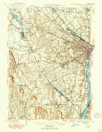
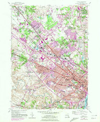
The Albany quadrangle captures a major New York crossroads where the state capital meets the growing suburbs of Colonie and Latham. This modern topographical survey highlights a dense landscape of institutional and educational landmarks, including the sprawling campus of SUNY Albany, Siena College, and the specialized medical cluster surrounding the Albany Medical Center. The urban fabric of the city is clearly defined by historic thoroughfares like Washington Ave and Western Ave, which branch out toward outlying settlements such as Roessleville and Newtonville.
Find a feature on this map
56 named features on this map. Tap any name to fly to it.
Don’t see what you’re looking for? This feature index may not catch every label — zoom into the map to look around manually.
Map Details
Editions of this 2023 Albany Map
This is the sole edition of this map. No revisions or reprints were ever made.
Historical Maps of Dunes Through Time
17 maps found

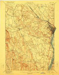
1893 Albany
Albany County, NY

1895 Albany
Albany County, NY
1898 Albany
Albany County, NY
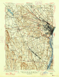
1927 Albany
Albany County, NY
1947 Albany
Albany County, NY

1948 Albany
Albany County, NY
1950 Albany
Albany County, NY
1953 Albany
Albany County, NY
1956 Albany
Albany County, NY

1957 Albany
Albany County, NY

1959 Albany
Albany County, NY

1962 Albany
Albany County, NY
1978 Albany
Albany County, NY

1986 Albany
Albany County, NY

1989 Albany
Albany County, NY
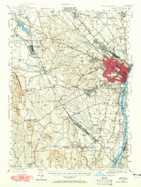
1994 Albany
Albany County, NY
2023 Albany
Albany County, NY