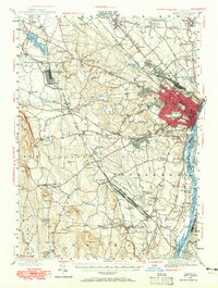
1947 Map of Albany
USGS Topo · Published 1965About this map
The city of Albany dominates the eastern edge of this mid-century survey, its dense street grid concentrated around the Capitol, Armory, and Governors Mansion. To the west, the landscape transitions into the distinct townships of Guilderland and New Scotland, where the Helderberg Mountains rise toward Wolf Hill. The era's transportation network is prominently displayed, showing the New York Central and Delaware and Hudson railroads intersecting at Voorheesville, near the significant Voorheesville Army Sub Depot logistics site.
Find a feature on this map
111 named features on this map. Tap any name to fly to it.
Don’t see what you’re looking for? This feature index may not catch every label — zoom into the map to look around manually.
Map Details
Editions of this 1947 Albany Map
This is the sole edition of this map. No revisions or reprints were ever made.
Other maps of this area

1893 · Cohoes
USGS Topo · 1:62,500

1893 · Troy
USGS Topo · 1:62,500

1893 · Schenectady
USGS Topo · 1:62,500

1893 · Coxsackie
USGS Topo · 1:62,500

1893 · Durham
USGS Topo · 1:62,500

1893 · Albany
USGS Topo · 1:62,500

1894 · Coxsackie
USGS Topo · 1:62,500

1894 · Durham
USGS Topo · 1:62,500

1895 · Troy
USGS Topo · 1:62,500

1895 · Cohoes
USGS Topo · 1:62,500