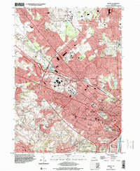
1994 Map of Albany
USGS Topo · Published 2000About this map
The State Capitol stands as the centerpiece of this mid-century topographic record, which documents the post-war expansion of New York's capital. The landscape reveals a dense urban core transitioning into rapidly developing suburbs like Colonie and Loudonville. Major institutional landmarks, such as the Ann Lee Home and the State Office Building Campus, are prominent alongside dozens of numbered public schools, reflecting the city's civic infrastructure during this era.
Find a feature on this map
95 named features on this map. Tap any name to fly to it.
Don’t see what you’re looking for? This feature index may not catch every label — zoom into the map to look around manually.
Map Details
Editions of this 1994 Albany Map
This is the sole edition of this map. No revisions or reprints were ever made.
Other maps of this area

1893 · Cohoes
USGS Topo · 1:62,500

1893 · Troy
USGS Topo · 1:62,500

1893 · Schenectady
USGS Topo · 1:62,500

1893 · Albany
USGS Topo · 1:62,500

1895 · Troy
USGS Topo · 1:62,500

1895 · Cohoes
USGS Topo · 1:62,500

1895 · Albany
USGS Topo · 1:62,500

1895 · Schenectady
USGS Topo · 1:62,500

1898 · Schenectady
USGS Topo · 1:62,500

1898 · Albany
USGS Topo · 1:62,500