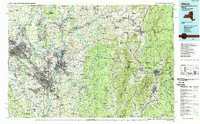
1989 Map of Albany
USGS Topo · Published 1989About this map
The confluence of the Hudson River and Mohawk River anchors this late-twentieth-century study of New York’s Capital District and the neighboring mountains of Vermont and Massachusetts. This era of the region is defined by a dense transportation network, from the major interstate corridors of I-87 and I-90 to the established rail lines of the Conrail, D & H RR, and B & M RR. The map captures the suburban expansion of Albany, Schenectady, and Troy into communities like Loudonville, Latham, and Delmar.
Find a feature on this map
231 named features on this map. Tap any name to fly to it.
Don’t see what you’re looking for? This feature index may not catch every label — zoom into the map to look around manually.
Map Details
Editions of this 1989 Albany Map
2 editions found
Other maps of this area

1886 · Greylock
USGS Topo · 1:62,500

1886 · Hawley
USGS Topo · 1:62,500

1886 · Chesterfield
USGS Topo · 1:62,500

1886 · Becket
USGS Topo · 1:62,500

1888 · Becket
USGS Topo · 1:62,500

1888 · Berlin
USGS Topo · 1:62,500

1888 · Chesterfield
USGS Topo · 1:62,500

1888 · Pittsfield
USGS Topo · 1:62,500

1889 · Wilmington
USGS Topo · 1:62,500

1890 · Hawley
USGS Topo · 1:62,500