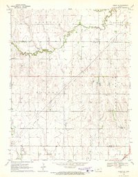
1970 Map of Albert SE
USGS Topo · Published 1972About this map
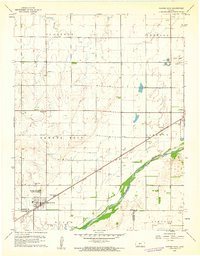
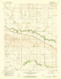
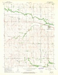
The meandering course of Walnut Creek and its tributary, Dry Walnut Creek, define the central landscape of this Pawnee County region at the start of the 1970s. The area represents a productive intersection of agriculture and energy extraction, most notably centered on the Rutherford Oil Field in the western portion of the sheet. Numerous individual Oil Wells and a Compressor Station are scattered across the townships, illustrating the technical infrastructure required for mid-continent petroleum production during this era.
Find a feature on this map
18 named features on this map. Tap any name to fly to it.
Don’t see what you’re looking for? This feature index may not catch every label — zoom into the map to look around manually.
Map Details
Editions of this 1970 Albert SE Map
This is the sole edition of this map. No revisions or reprints were ever made.
Other maps of this area

1889 · Larned
USGS Topo · 1:125,000

1891 · Great Bend
USGS Topo · 1:125,000

1891 · Larned
USGS Topo · 1:125,000

1893 · Great Bend
USGS Topo · 1:125,000

1955 · Great Bend
USGS Topo · 1:250,000

1957 · Great Bend
USGS Topo · 1:250,000

1958 · Great Bend
USGS Topo · 1:250,000
1960 · Pawnee Rock
USGS Topo · 1:24,000
1960 · Heizer
USGS Topo · 1:24,000
1965 · Albert
USGS Topo · 1:24,000