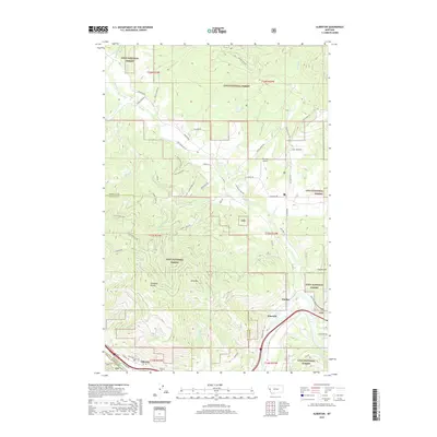
2020 Map of Alberton
USGS Topo · Published 2020About this map
The Clark Fork river valley serves as the primary corridor for commerce and travel in this part of western Montana, where the settlement of Alberton is situated along its northern banks. The landscape is defined by the steep elevation changes of the Ninemile Divide and Ellis Mtn, largely contained within the protected boundaries of the Lolo National Forest. Water is a constant presence, with numerous drainages like Ninemile Cr and Butler Cr flowing southward toward the river.
Find a feature on this map
72 named features on this map. Tap any name to fly to it.
Don’t see what you’re looking for? This feature index may not catch every label — zoom into the map to look around manually.
Map Details
Editions of this 2020 Alberton Map
This is the sole edition of this map. No revisions or reprints were ever made.
Other maps of this area

1911 · Lolo
USGS Topo · 1:250,000

1912 · Missoula
USGS Topo · 1:125,000

1913 · Lolo
USGS Topo · 1:250,000

1956 · Wallace
USGS Topo · 1:250,000

1956 · Hamilton
USGS Topo · 1:250,000

1959 · Hamilton
USGS Topo · 1:250,000

1959 · Tarkio
USGS Topo · 1:62,500

1959 · Alberton
USGS Topo · 1:62,500

1960 · Wallace
USGS Topo · 1:250,000

1960 · Hamilton
USGS Topo · 1:250,000